QuickbarDorf: Unterschied zwischen den Versionen
Aus VolynWiki
Admin (Diskussion | Beiträge) K |
Admin (Diskussion | Beiträge) K |
||
| Zeile 1: | Zeile 1: | ||
<noinclude> | <noinclude> | ||
{{QuickbarDorf | {{QuickbarDorf | ||
| − | |Ort= | + | |Ort=Rowno |
| + | |Alt=(Riwne, Równe, Рівне, Rivne, Ровно) | ||
|Bild=[[Bild:Dresden_Frauenkirche.jpg|noframe|300px|Dresdener Frauenkirche]] | |Bild=[[Bild:Dresden_Frauenkirche.jpg|noframe|300px|Dresdener Frauenkirche]] | ||
| − | |Positionskarte= | + | |Positionskarte=GW |
| − | |GeoLat= | + | |GeoLat=50.621835 |
| − | |GeoLong= | + | |GeoLong=26.243935 |
| − | | | + | |Info4 = bla |
| − | |||
| − | |||
| − | |||
| − | |||
}} | }} | ||
| Zeile 21: | Zeile 18: | ||
|Alt = <!-- andere Namen --> | |Alt = <!-- andere Namen --> | ||
|Bild = <!-- [[Bild:|noframe|300px|]] --> | |Bild = <!-- [[Bild:|noframe|300px|]] --> | ||
| − | |Positionskarte= | + | |Positionskarte=GW |
|Ujesd = | |Ujesd = | ||
|Wolost = | |Wolost = | ||
| Zeile 43: | Zeile 40: | ||
<includeonly> | <includeonly> | ||
<div style="float: right; margin: 0 0 1em 1em;"> | <div style="float: right; margin: 0 0 1em 1em;"> | ||
| − | {| cellpadding="2" cellspacing="0" style="border: 1px solid # | + | {| cellpadding="2" cellspacing="0" style="border: 1px solid #AAA; background-color: #f3f3ff" width="300" |
|- | |- | ||
| − | | colspan="2" style="font-size: larger; text-align: center; border-bottom: | + | | colspan="2" style="font-size: larger; text-align: center; border-bottom: 10px solid #AAA; background-color: #DBE0EB" | '''{{{Ort}}}'''{{if|test={{{Alt|}}}|then=<br/><br/>''{{{Alt}}}''|else=}} |
|- | |- | ||
{{if|test={{{Positionskarte|}}}|then={{quickbar image|heading=Lage|image={{Positionskarte|{{{Positionskarte}}}|{{{GeoLat}}}|{{{GeoLong}}}|{{{Ort}}} }} }} }} | {{if|test={{{Positionskarte|}}}|then={{quickbar image|heading=Lage|image={{Positionskarte|{{{Positionskarte}}}|{{{GeoLat}}}|{{{GeoLong}}}|{{{Ort}}} }} }} }} | ||
|- | |- | ||
| − | | colspan="2" style="text-align: center; border-top: 1px solid # | + | | colspan="2" style="text-align: center; border-top: 1px solid #AAA; border-bottom: 1px solid #AAA; background-color: #DBE0EB" | '''Kurzdaten''' |
{{if|test={{{Ujesd|}}}|then={{quickbar item|heading=Ujesd|value={{{Ujesd|}}}}}|else={{quickbar empty}}}} | {{if|test={{{Ujesd|}}}|then={{quickbar item|heading=Ujesd|value={{{Ujesd|}}}}}|else={{quickbar empty}}}} | ||
{{if|test={{{Wolost|}}}|then={{quickbar item|heading=Wolost|value={{{Wolost|}}}}}|else={{quickbar empty}}}} | {{if|test={{{Wolost|}}}|then={{quickbar item|heading=Wolost|value={{{Wolost|}}}}}|else={{quickbar empty}}}} | ||
{{if|test={{{Namen|}}}|then={{quickbar item|heading=andere Namen|value={{{Namen|}}}}}|else={{quickbar empty}}}} | {{if|test={{{Namen|}}}|then={{quickbar item|heading=andere Namen|value={{{Namen|}}}}}|else={{quickbar empty}}}} | ||
{{if|test={{{GeoLat}}}|{{{GeoLong}}}|then={{quickbar item|heading=Koordinaten|value={{Dez2Deg|{{{GeoLat}}}|{{{GeoLong}}}}}}}||else={{quickbar empty}}}} | {{if|test={{{GeoLat}}}|{{{GeoLong}}}|then={{quickbar item|heading=Koordinaten|value={{Dez2Deg|{{{GeoLat}}}|{{{GeoLong}}}}}}}||else={{quickbar empty}}}} | ||
| − | {{if|test={{{Einwohner1|}}}|then={{quickbar item|heading=Einwohner 1888 | + | {{if|test={{{Einwohner1|}}}|then={{quickbar item|heading=Einwohner 1888|value={{{Einwohner1|}}}}}|else={{quickbar empty}}}} |
| − | {{if|test={{{Einwohner2|}}}|then={{quickbar item|heading=Einwohner 1906 | + | {{if|test={{{Einwohner2|}}}|then={{quickbar item|heading=Einwohner 1906|value={{{Einwohner2|}}}}}|else={{quickbar empty}}}} |
| − | {{if|test={{{Kirchspiel|}}}|then={{quickbar item|heading=Kirchspiel | + | {{if|test={{{Kirchspiel|}}}|then={{quickbar item|heading=Kirchspiel|value={{{Kirchspiel|}}}}}|else={{quickbar empty}}}} |
| − | {{if|test={{{Stadt_Website|}}}|then={{quickbar item|heading=Website | + | {{if|test={{{Stadt_Website|}}}|then={{quickbar item|heading=Website|value=[{{{Stadt_Website|}}}}} offizielle Website von {{{Ort}}}]|else={{quickbar empty}}}} |
{{if|test={{{Info1|}}}|then={{Heading|Zusatzinfo}} | | {{if|test={{{Info1|}}}|then={{Heading|Zusatzinfo}} | | ||
else={{if|test={{{Info2|}}}|then={{Heading|Zusatzinfo}} | | else={{if|test={{{Info2|}}}|then={{Heading|Zusatzinfo}} | | ||
| Zeile 63: | Zeile 60: | ||
else={{if|test={{{Info4|}}}|then={{Heading|Zusatzinfo}} | else={{if|test={{{Info4|}}}|then={{Heading|Zusatzinfo}} | ||
}} }} }} }} | }} }} }} }} | ||
| − | {{if|test={{{Info1|}}}|then={{quickbar item|heading=Info1 | + | {{if|test={{{Info1|}}}|then={{quickbar item|heading=Info1|value={{{Info1|}}}}}|else={{quickbar empty}}}} |
| − | {{if|test={{{Info2|}}}|then={{quickbar item|heading=Info2 | + | {{if|test={{{Info2|}}}|then={{quickbar item|heading=Info2|value={{{Info2|}}}}}|else={{quickbar empty}}}} |
| − | {{if|test={{{Info3|}}}|then={{quickbar item|heading=Info3 | + | {{if|test={{{Info3|}}}|then={{quickbar item|heading=Info3|value={{{Info3|}}}}}|else={{quickbar empty}}}} |
| − | {{if|test={{{Info4|}}}|then={{quickbar item|heading=Info4 | + | {{if|test={{{Info4|}}}|then={{quickbar item|heading=Info4|value={{{Info4|}}}}}|else={{quickbar empty}}}} |
|} | |} | ||
</includeonly> | </includeonly> | ||
Version vom 6. November 2009, 23:27 Uhr
- Funktion
- Erzeugt eine Informationsbox mit Positionskarte und wichtigen Daten eines Ortes.
- Kopiervorlage
- (Kommentare bei Bedarf entfernen!)
{{QuickbarDorf
|Ort        ={{PAGENAME}}
|Alt        = <!-- andere Namen -->
|Bild       = <!-- [[Bild:|noframe|300px|]] -->
|Positionskarte=GW
|Ujesd      =
|Wolost     =
|GeoLat     =
|GeoLong    =
|Einwohner1 = <!-- 1888 -->
|Einwohner2 = <!-- 1906 -->
|Kirchspiel =
|Website    =
|Info1      =
|Info2      =
|Info3      =
|Info4      =
}}
- Parameter
-
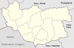
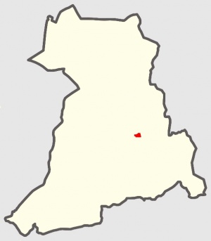
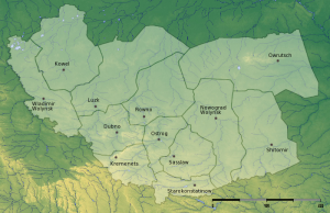
- Positionskarte → Legt die verwendete Karte fest. Mögliche Codes siehe Vorlage:Positionskarte
- GeoLat und GeoLat → Die geografischen Koordinaten der Stadt im dezimalen Format. Aus ihnen wird die Position des roten Punktes ermittelt, der die Lage markiert. Ermitteln kann man die Werte z.B. indem man im entsprechenden WikiPedia-Artikel auf die Koordinaten rechts oben klickt. Es öffnet sich die Seite "Map Sources/GeoHack". Rechts neben den fettgedruckten Koordinaten im Grad/Minuten/Sekunden-Format steht die benötigte dezimale Schreibweise.


